Map of Aurelion

This regional map presents Aurelion's major arcane institutions, wild-magic landmarks, mage enclaves, shrines, crossings, mountain passes, and the road west toward Eirlyn. Use it as the primary geographic reference when traveling through the First Weave.

Aurelion Regional Map The First Weave

Arcane Landmarks and the Flying City

Aurelion is dominated by magical geography. Skyreach of Vel’Tharion hangs above the eastern mountains, while the Silent Collegium, Obsidian Archive, Luminous Vale, Weavefall Basin, Fractured Crown, and Astryx Convergence anchor the region's great arcane sites. Smaller shrines, enclaves, crossings, overlooks, and watch stations connect these landmarks along old roads and ley-linked paths.
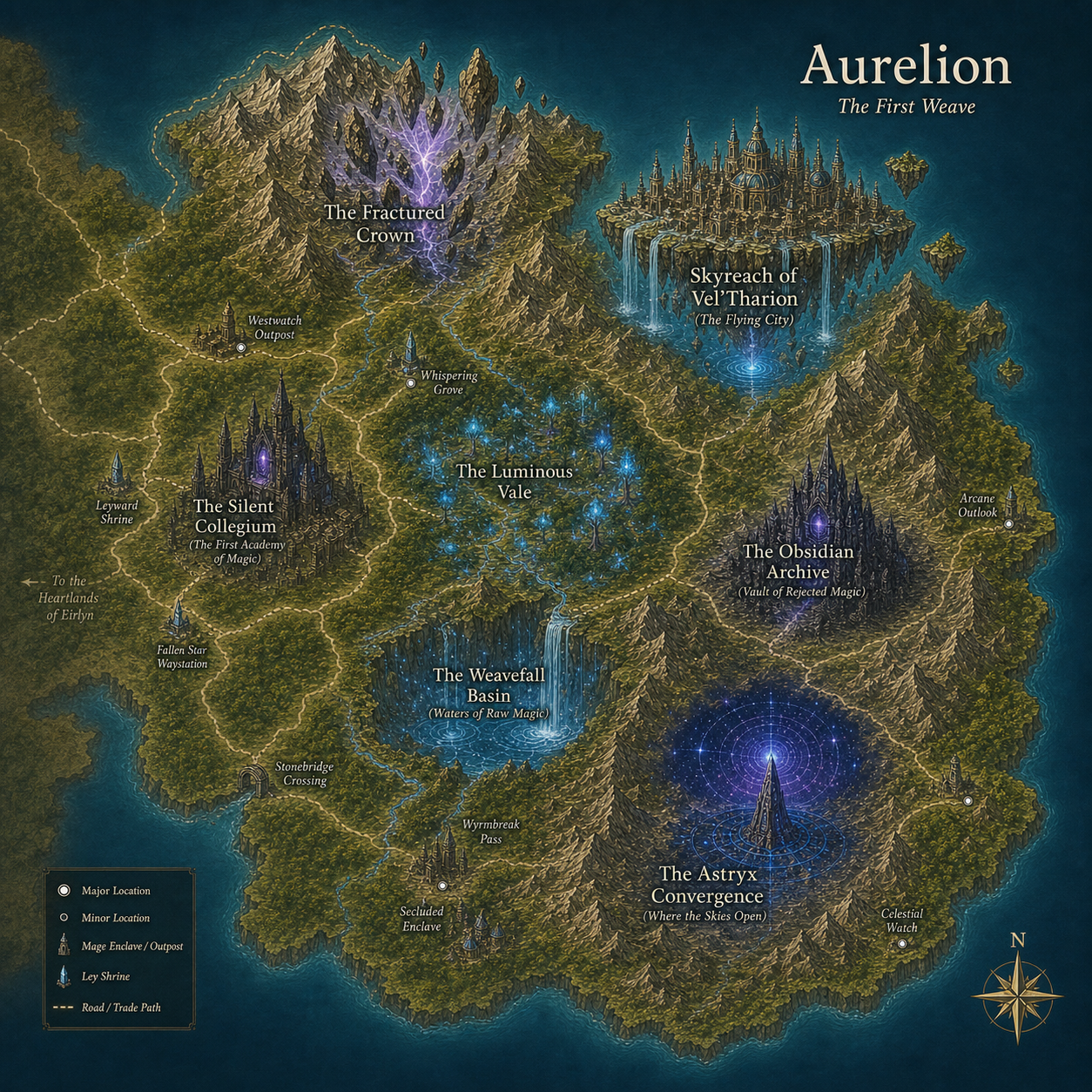
Regional map of Aurelion Skyreach of Vel’Tharion The Silent Collegium The Obsidian Archive The Astryx Convergence The Fractured Crown The Luminous Vale The Weavefall Basin Westwatch Outpost Whispering Grove Leyward Shrine Fallen Star Waystation Secluded Enclave Arcane Outlook Celestial Watch Stonebridge Crossing Wyrmbreak Pass To the Heartlands of Eirlyn
Aurelion — click any named location or the route to Eirlyn to open its page.
Regional Atlas: This page is dedicated to the map of Aurelion. Select a named location directly on the map or use the Aurelion navigation menu to explore the region in greater detail.