Eirlyn Regional Map
Forests, Crossings and Ancient Sites
Eirlyn's roads weave between Syl-Vaelar, Greenveil Crossing, Thornreach Village, Mistwake Port, and Cara’s-I-ngelaidh. The map also marks the Stone Reaches, Leyroot Hollow, Moonveil Glade, Verdant Scar, Whispering Falls, Mossvault, Jade Labyrinth, Starfall Basin, the Sunken Rings, and other important sites hidden beneath the forest canopy.
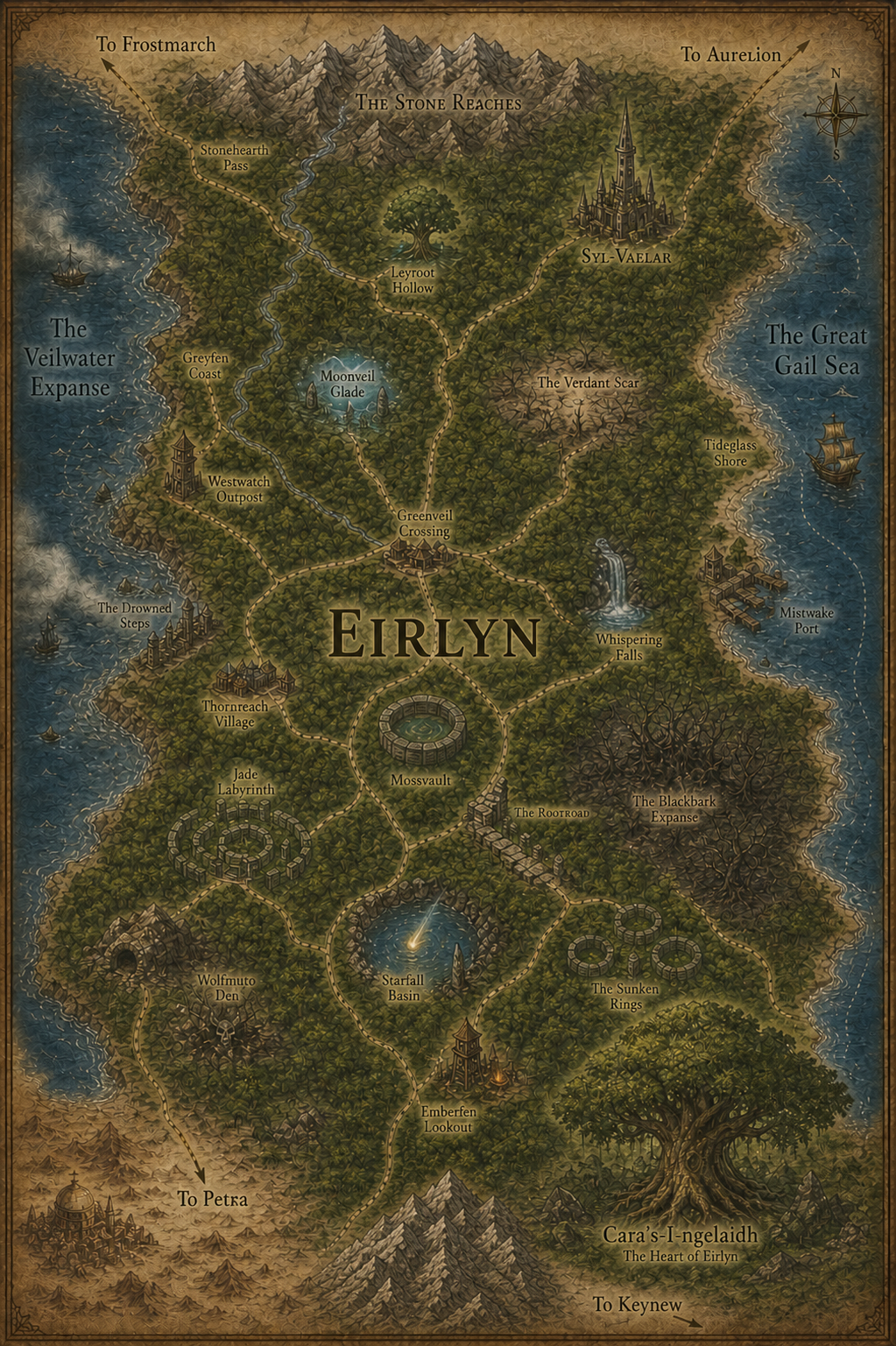
Eirlyn — click any named location or neighboring-region route on the map to open its page.
Syl-Vaelar
Cara’s-I-ngelaidh
Thornreach Village
Mistwake Port
Westwatch Outpost
Greenveil Crossing
Stonehearth Pass
Emberfen Lookout
Mossvault
Jade Labyrinth
Sunken Rings
Drowned Steps
Wolfmuto Den
Stone Reaches
Leyroot Hollow
Moonveil Glade
Verdant Scar
Whispering Falls
Blackbark Expanse
Starfall Basin
Greyfen Coast
Veilwater Expanse
Great Gail Sea
Rootroad
World Map