Map of Frostmarch

This regional map presents Frostmarch's glacial cities, frozen seas, mountain ranges, tribal camps, ice caves, roads, and the southern route into Eirlyn. Use it as the primary geographic reference when traveling through the arctic crown of Abadonya.

Frostmarch Regional Map The Arctic Crown

Ice, Stone and the Northern Lights

Frostmarch is defined by immense glaciers, jagged mountain ranges, frozen waters, and hard roads cut through the northern wilderness. Kjolheim and Frostforged Hold stand as major strongholds, while the Everfrost Glacier, Icecrown Peaks, Frostgiant Wastes, Frozen Mirror Lake, Aurora Plains, Veilgate Grottos, Glacierfall Cliffs, Winterbind Camps, and the Bitterwind Isles mark the region's most important wilderness sites.
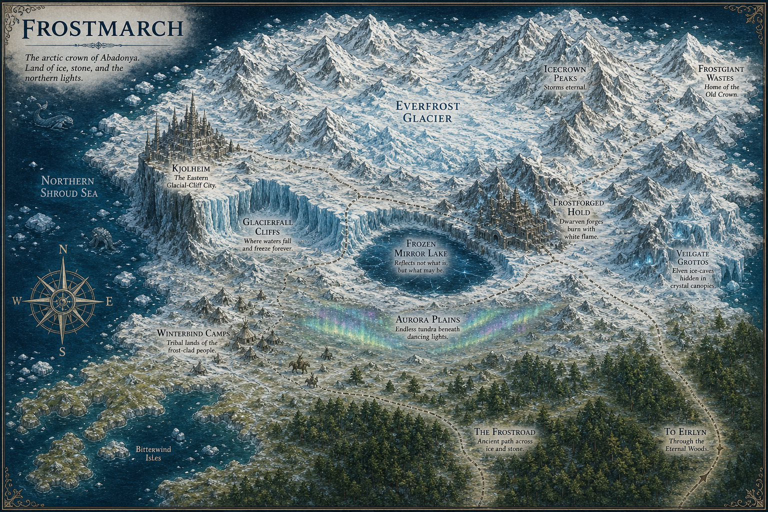
Regional map of Frostmarch Kjolheim Frostforged Hold Winterbind Camps Veilgate Grottos Everfrost Glacier Icecrown Peaks Frostgiant Wastes Glacierfall Cliffs Aurora Plains Northern Shroud Sea Frozen Mirror Lake Bitterwind Isles The Frostroad To Eirlyn
Frostmarch — click any named location or the route to Eirlyn to open its page.
Regional Atlas: This page is dedicated to the map of Frostmarch. Select a named location directly on the map or use the Frostmarch navigation menu to explore the region in greater detail.