The Cinder Trail

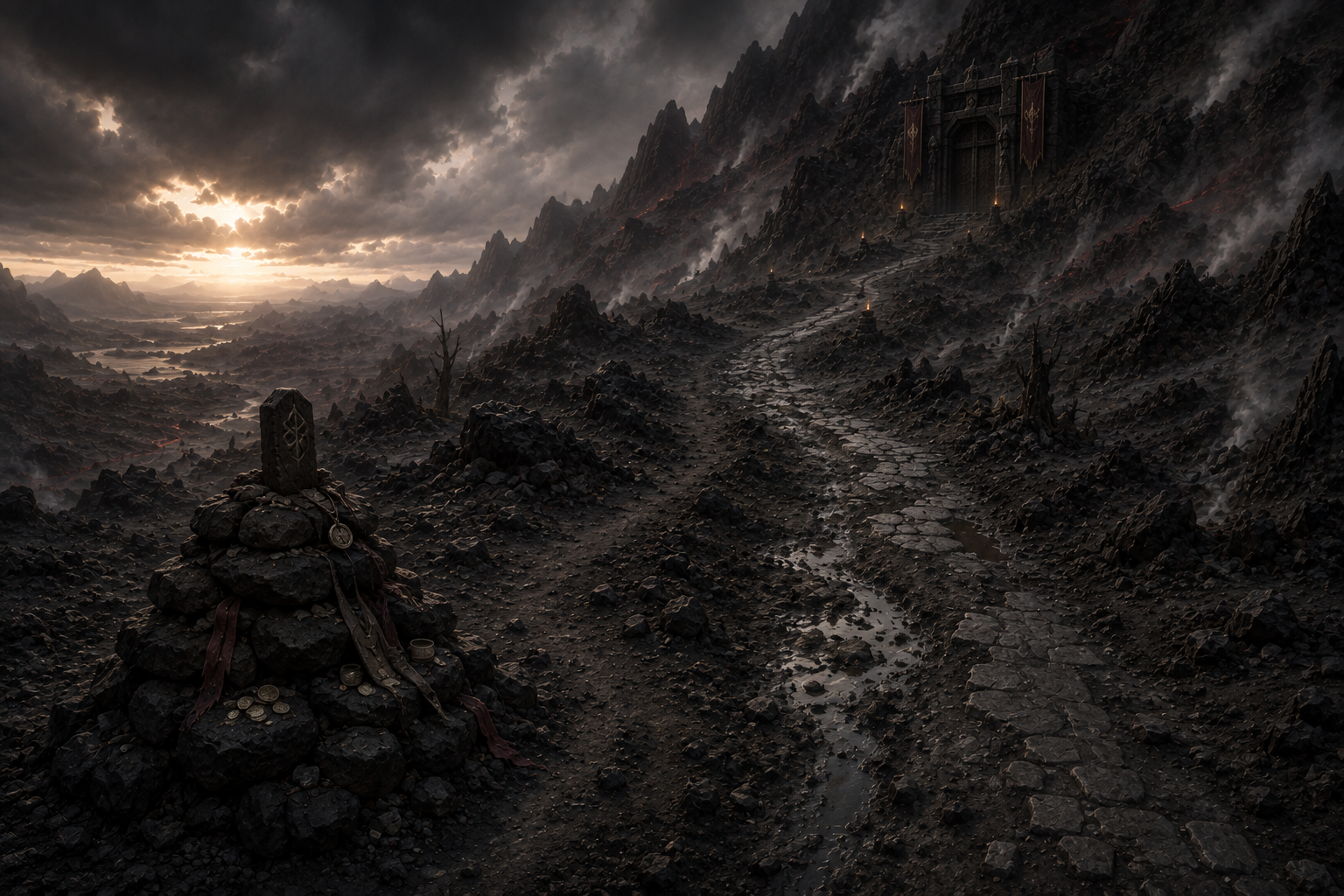
A blackened road of volcanic stone and windblown ash, the Cinder Trail winds through Keynew's western reach toward the sealed gates of Dragonsmane. It is not a town, fort, or destination in its own right, but a landmark route remembered in old war stories, dwarven songs, and the warnings of every caravan master who has crossed the region.

The Cinder Trail of Abadonya
Road to the Sealed MountainKeynew Landmark

Overview

The Cinder Trail begins where the western roads leave the greener farmland of central Keynew and the land begins to darken beneath the shadow of Dragonsmane. From there, the road climbs gradually through old lava fields, ash valleys, and broken ridges until it reaches the final approach to the mountain's sealed dwarven gates.

Most travelers never walk the trail end to end. Hunters, prospectors, pilgrims, scavengers, and reckless adventurers use portions of it, but the road becomes increasingly desolate as it nears Dragonsmane. The last miles are marked by silence, old stonework, and a sense that the mountain is watching.

Origins of the TrailHistory

A Dwarven Road Beneath Human Feet

The oldest portions of the Cinder Trail predate modern Keynew. The road was once part of the great dwarven approach to Dragonsmane, cut wide enough for ore wagons, marching companies, and heavy trade caravans. Its foundation stones are black basalt, fitted so tightly that in places even centuries of ash have not broken them apart.

During the dwarven-human war, the trail became a military road. Human forces advanced along it toward Dragonsmane while dwarven defenders used the ridges above to slow the approach. When Dragonsmane's gates were sealed, the road lost its purpose almost overnight.

Since then, Keynew maps have continued to mark the route, but few official patrols travel beyond the safer western reaches.

The Road TodayTravel Conditions

Ash, Stone, and Wind

The Cinder Trail is broad enough for wagons near its eastern end, but it narrows and fractures as it climbs west. Ash drifts can swallow wheel ruts in a single night, and sudden winds send black dust skittering across the road like smoke.

Rain is uncommon near the higher reaches, but when it comes the ash turns to heavy gray mud. Old lava channels cut across the road, and in several places travelers must detour around collapsed sections where the original dwarven stone has sunk or split.

There are no inns, permanent settlements, or official toll stations along the upper road. Travelers must bring their own shelter, water, and firewood.

Notable WaypointsLandmarks

Places Along the Trail

Ashfall Watch. A ruined lookout overlooking the western road and the volcanic country beyond. Travelers often stop there to judge weather and ash conditions before continuing.

The Burned Mile. A stretch of road where the basalt is glassy and warped, as if the ground itself once burned hot enough to soften stone.

Three Hammers Marker. A broken dwarven milepost carved with three hammer heads. No one agrees what distance it once measured.

The Cinder Fork. A split where the main road continues toward Dragonsmane while an older side route winds toward abandoned mining country.

The Last Cairn. A pile of black stones where travelers traditionally leave a token before entering the final stretch toward the mountain.

The Gate Approach. The final rise before Dragonsmane's sealed entrance. Here the road broadens again, revealing the monumental scale of the ancient dwarven work.

Old Dwarven MarkersRoadside Lore

Words Cut into Basalt

Weathered dwarven symbols appear along the road on retaining walls, bridge stones, and half-buried pillars. Most are practical marks indicating grade, distance, water, or quarry routes, but some have been interpreted as prayers or military warnings.

Dwarves traveling the trail often touch these carvings as they pass. Some refuse to translate the older inscriptions for outsiders, saying the road belongs to the memory of Dragonsmane and should not be reduced to curiosities.

Hazards of the Cinder TrailWilderness

Why Few Travel West

Ashstorms can reduce visibility to a few paces and make breathing difficult. Loose scree and brittle volcanic shelves make the higher ridges dangerous for mounts. Heat vents sometimes open along old cracks after tremors, releasing hot air and sulfurous fumes.

Travelers also report scavenger beasts, territorial predators, and the occasional band of tomb-seekers or relic hunters. The closer one travels toward Dragonsmane, however, the fewer living creatures are seen.

Legends of the RoadLocal Belief

The Road That Waits

Among human settlements, the Cinder Trail is often called the Road of the Dead Mountain, a warning that nothing good lies beyond its final rise.

Dwarves use different language. To many of them, the trail is not a road to a tomb but a road awaiting its people. Old sayings claim that when Dragonsmane opens again, the first sign will not be the gates themselves, but footprints appearing in the ash of the Cinder Trail before dawn.

Another story says the road will one day carry a procession out of the mountain so vast that every old mile marker will ring like struck metal.

Rumors & Adventure HooksCampaign Use

What Travelers Say

A caravaner swears a fresh dwarven rune appeared on an old marker after a minor earthquake. A scavenger claims to have seen torchlight moving near the Gate Approach. A Keynew patrol found wagon tracks heading west but none returning. A dwarf from Mendiville has begun paying adventurers to recover old waystones from the upper trail. And after certain nights, travelers report hearing hammers far beneath the road.

The Cinder Trail works well as a transitional adventure route: a place for wilderness encounters, investigations, lost war relics, escorts, rival expeditions, and mounting dread before the party ever reaches Dragonsmane itself.