Map of Petra

This regional map presents Petra's major settlements, desert roads, mountain barriers, ruins, and dangerous landmarks. Use it as the primary geographic reference when traveling through Petra and the Glass Wastes.

Petra Regional Map Desert Roads & Ancient Sites

The Glass Road Through Petra

Petra is crossed by the Glass Road, linking the northern approaches from Eirlyn with Venj Oasis, Zae'Halem, Stonegate Pass, and the route toward Keynew. Beyond the road lie the Forgotten Caravan, Glass Wastes, Bleeding Basin, Emberfall Scar, Stone Choir, and the Sunken Temple of Earth.
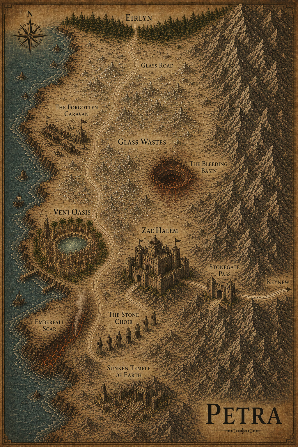
Regional map of Petra Eirlyn Keynew Glass Road Stonegate Pass The Forgotten Caravan Glass Wastes The Bleeding Basin The Stone Choir Sunken Temple of Earth Venj Oasis Zae'Halem Emberfall Scar
Petra — click any named location on the map to open its page.
Regional Atlas: This page is dedicated to the map of Petra. Select a named location directly on the map or use the Petra navigation menu to explore the region in greater detail.