
Map of Keynew

This regional map presents Keynew's major cities, roads, river crossings, forest approaches, western mountain routes, and important landmarks. Use it as the primary geographic reference when traveling through Keynew.

Keynew Regional Map Heartland & Trade Region

Roads Between Golandria, Koin, Mendiville and Dragonsmane

Keynew's map centers on its connected roads and river crossings, from Golandria and Koin on the Great Gail Sea to Mendiville, Dragonsmane, and the forest approaches toward Cara’s-I-ngelaidh. Smaller landmarks such as Ashfall Watch, the Cinder Trail, Ironcrest Outpost, the Old Wall, Coinspire Tower, and Blackmarket Row are marked along the routes.
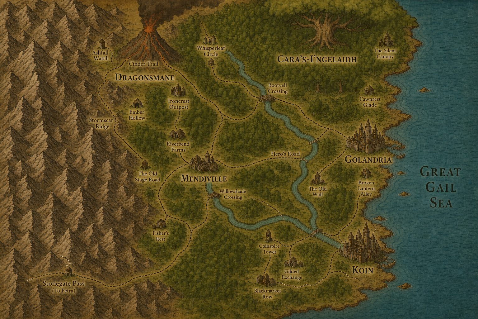
Regional map of Keynew Ashfall Watch Cinder Trail Dragonsmane Stormscar Ridge Ember Hollow Ironcrest Outpost Riverbend Farms The Old Stage Road Fisher's Rest Stonegate Pass Whisperleaf Circle Rootveil Crossing Cara’s-I-ngelaidh The Silent Canopy Fawnrest Glade Mendiville Willowshade Crossing Hero’s Road Golandria The Old Wall Broken Lantern Alley Coinspire Tower Gilded Exchange Blackmarket Row Koin Great Gail Sea
Keynew — click any named location on the map to open its page.
Regional Atlas: This page is dedicated to the map of Keynew. Select a marked location or use the Keynew navigation menu to explore the region in greater detail.